Lidar observations in South Korea: MRS.LEA
 We are operating a Raman lidar at our partner university, the Gwangju Institute of Science and Technology (GIST) in South Korea.
The instrument in its basic version of a 3+2 system has been developed since 2000. A substantial upgrade of the system began in end of 2008. This lidar serves as atmospheric laboratory and it is a central part of our work carried out in our laboratory at the University of Hertfordshire.
At the University of Hertfordshire we develop lidar instrument technology under controlled environmental conditions (closed laboratory). This technology then can be tested under real atmospheric conditions at GIST.
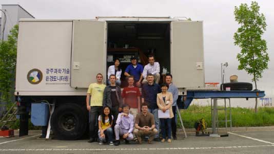
Lidar team at GIST, May 2011
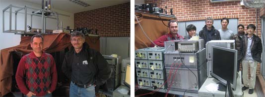
Our instrument at GIST, dubbed MRS.LEA (Multi-wavelength aerosol/depolarization/Raman‐Quartz/water-vaporSpectroscopyLidar system inEastAsia) is a high-end multiwavelength Raman lidar that possesses many more measurement channels than a 3+2 lidar. The instrument has been specifically built in order to meet the demands for characterizations of the complex pollution over East Asia, which is characterized by mixtures of urban haze with mineral dust, and smoke that is transported over long distances from East Siberia and from near distances due to the burning of agricultural waste in Korea.
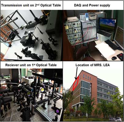
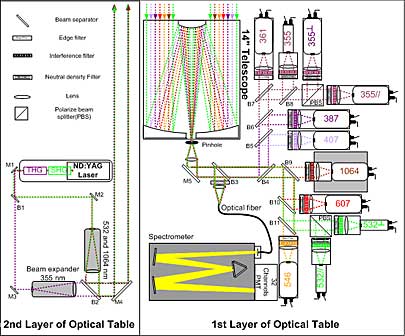
MRS.LEA is installed in the DASAN Building. The coordinates of the instruments are 35.22828° North and 126.84314° East at a height of 52.0 Meters above sea level. The photos above show some of the layout of the transmitter unit (top, left), data acquisition system (top, right) and the signal receive system (bottom, left). Further details on the optical layout of the transmitter and receiver units are shown below. The numbers indicate the wavelengths at which lidar signals are detected by the photomultiplier tubes.
Data products from MRS.LEA measurements
The following list provides an overview on the primary optical data products that we can measure with MRS.LEA:
- Particle backscatter coefficients at 355, 532 and 1064 nm
- Particle extinction coefficients at 355 and 532 nm from measurements of the vibration-rotational Raman signals at 387 (excitation wavelength of 355 nm) and 607 nm (excitation wavelength of 532 nm)
- Particle linear depolarization ratios at 355 and 532 nm
- Water vapor mixing-ratio from measurements of the vibration-rotational Raman signals at 387 and 407 nm (excitation wavelength of 355 nm)
- Silicon-dioxide backscatter coefficient at 361 and 546 nm from measurements of the vibration-rotational Raman signals at 361/387 nm (excitation wavelength of 355 nm) and 546/607 nm (excitation wavelength of 532 nm)
From these primary optical data products we obtain the following additional optical data products:
- Particle extinction-to-backscatter (lidar) ratios at 355 and 532 nm
- Extinction-related Ångström exponents for the wavelength pair 355/532 nm
- Backscatter-related Ångström exponents for the wavelength pairs 355/532 nm and 532/1064 nm
- Particle linear depolarization-ratio related Ångström exponent for the wavelength pair 355/532 nm
- Silicon-dioxide backscatter-related Ångström exponent for the wavelength pair 361/546 nm
Additional parameters that can be obtained from the optical data:
- Knowledge of the backscatter cross section allows us to determine the profile of the silicon-dioxide concentration in a pollution plume
- Knowledge of the content of silicon-dioxide in mineral dust particles, which can be obtained from a chemical analysis of dust samples, allows us to determine profiles of mass concentration of dust in the air
- We use the optical parameters of backscatter and extinction coefficients to determine profiles of microphysical parameters of spherical particles on the basis of an inversion algorithm we are developing and improving since 1994:
- Particle size distribution, effective radius, number, surface-area, and volume concentration. All parameters are provided in the fine and coarse mode fraction. We set the boundary between fine and coarse mode at 1 µm particle radius
- Complex refractive index; wavelength- and size-independent
- We compute from the particle size distributions and complex refractive indices profiles of scattering and absorption coefficients and the single-scattering albedo. All parameters are given at 355, 532, and 1064 nm. The wavelength dependence only reflects the effect of particles size, but not the wavelength dependence of the complex refractive index
- We currently use the AERONET light-scattering model (ellipsoids) to mimic the light-scattering properties of non-spherical particles, e.g. mineral dust
- We infer the effective radius of mineral dust
- This light-scattering model does not allow us to determine the complex refractive index
AERONET Sun Photometer at GIST
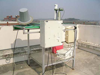
The Cimel sunphotometer is a multi-channel, automatic sun-and-sky scanning radiometer that measures the direct solar irradiance and sky radiance at the Earth's surface. Measurements are taken at pre-determined discrete wavelengths in the visible and near-infrared parts of the spectrum to determine atmospheric transmission and scattering properties. This instrument is weather-proof and requires little maintenance during periods of adverse weather conditions. It takes measurements only during daylight hours (sun above horizon).
Our Cimel sunphotometer is part of AERONET (Aerosol Robotic Network). The identification number of our instrument is 321.